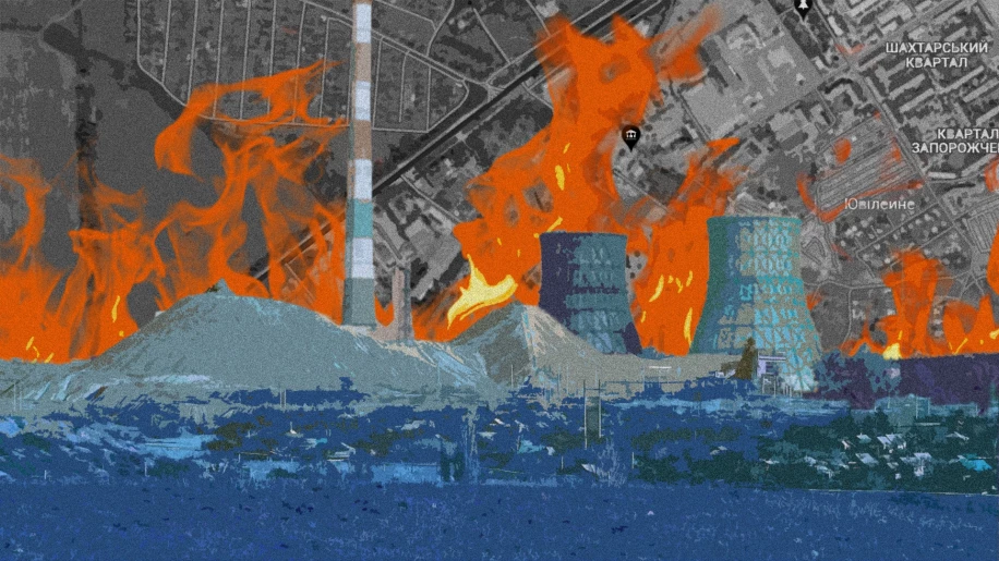
In the Telegram channel "Trukha⚡️Ukraine" we found a message that contained good news about the liquidation of fascists. So: temporarily occupied territory of Luhansk (ORDLO territory), the Yuvileyne mine is on fire. According to unconfirmed information, either employees of the Russian FSS or Russian special forces stationed in the affected buildings at that time were killed after the attack by the Armed Forces of Ukraine. 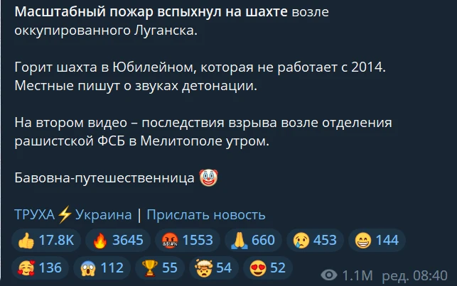
Find what lies on the surface
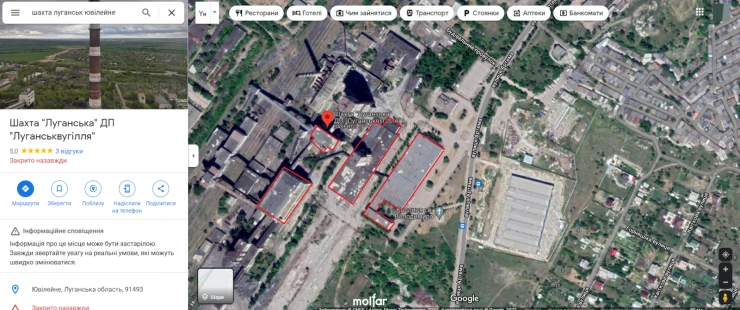
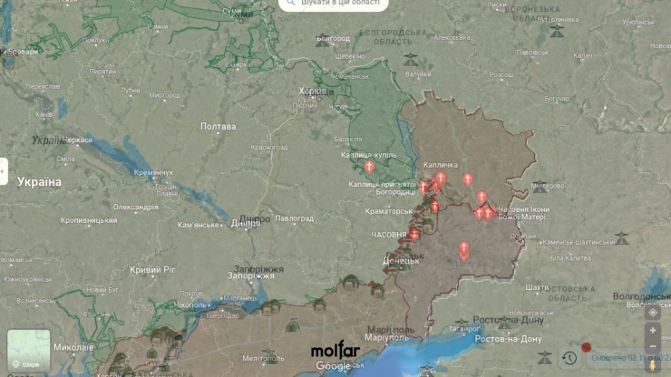
The first thing we did was a simple Google query, "Luhansk Yuvileyne Mine". So, we immediately realized that this is basically a well-known place that is not difficult to find on the map. However, we still don’t know what the building was damaged. It is not interesting to simply find a sector of fire. We need to establish the coordinates of the building that came under fire.

Constant observations are working
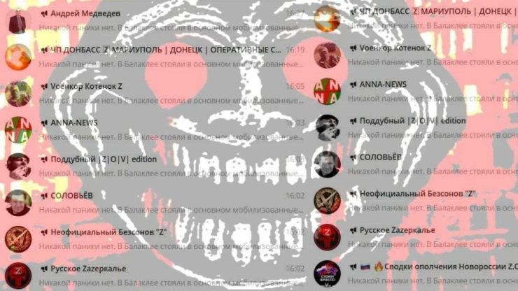
The next important point that gave us the opportunity to continue the investigation is passively accumulated information. Molfar researchers monitor Russian publications, channels and news resources. All the information we receive undergoes a primary analysis, after that, we label the information according to directions of the front: Donetsk region, Luhansk region, Kherson region and so on. After that, if possible, we try to identify the geolocation by photos and videos. Especially the area where there are many Russian military at the same time 😏
Why is watching Russian publications not as difficult as it might seem? They often make typical posts. Therefore, if you filter out all the repeated information, it turns out that there is not so much original, noteworthy content.
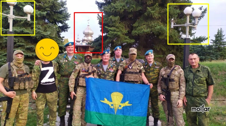
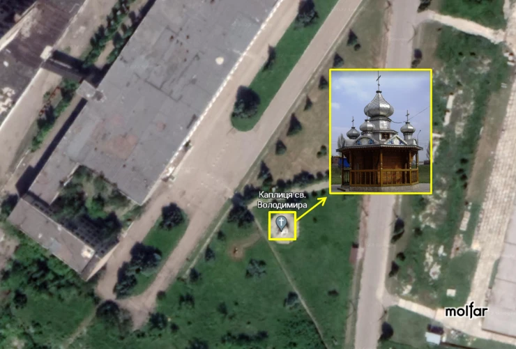
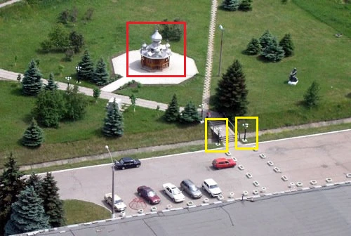
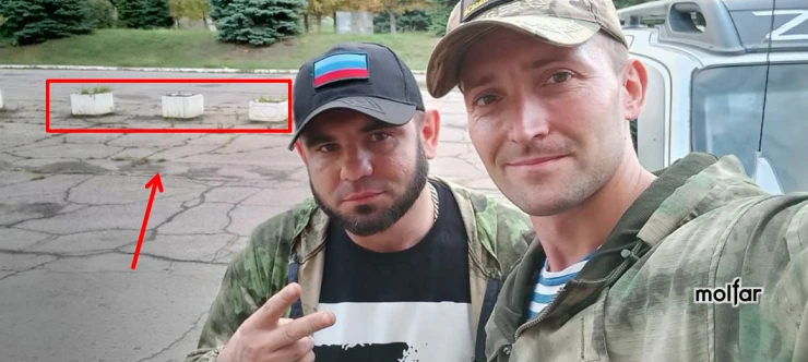
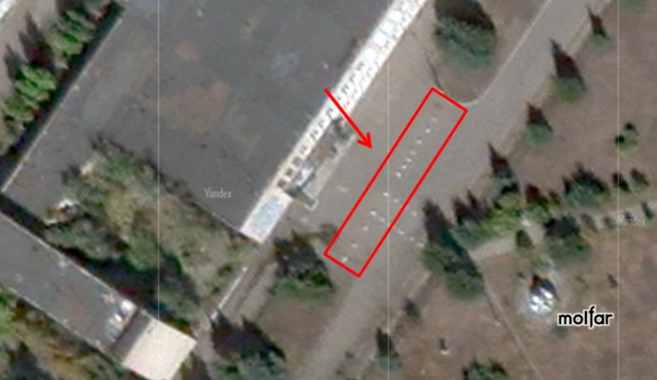
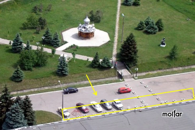
It happened this time as well, when we saw the news about the explosion, we remembered that we had already seen these neighborhoods and places. On September 1 (September 1 at 20:28), a Telegram-channel SEPAR ZOV LUGANSK DONETSK RF of the Russian military correspondent Oleg Tanasyuk published video (original post) of a concert held for a group of Russian military personnel in the assembly hall of the administrative building of the Luhansk-1 mine” (we established this later), as well as photos next to the chapel of St. Volodymyr, located opposite the central entrance to the administrative building of the mine management.
☝️ An attentive reader will ask: how did you understand that the video was published from the building of the Luhansk-1 mine – there is not a word about it in the original publication!
A very valid question. When we saw this publication in September, we did the next:
- we saw a photo of military personnel against the background of a church;
- opened Google maps;
- searched for "temple", "church", "chapel" (in Ukrainian) and "church" (in Russian);
- separately marked those objects located in the occupied territory by comparing the Google map and the DeepStateMAP;
- check the Google street photo of every church in Donetsk and Luhansk regions;
- found where the photo was taken.
Because in reality there are not so many temples, and the search area is limited only to the Donetsk and Luhansk regions. So, we quickly established the place where the photo was taken, then we added this publication to the observation archive under the name: Luhansk Region, Yuvileyne. And when the explosion happened, we already roughly understood that yes – there were Russian soldiers, we had seen them there before.
👉 So let's go back to the video by Oleg Tanasiuk. More than 50 servicemen (probably belonging to the Russian special forces) were filmed in the video. The military are at the concert in the assembly hall in mixed uniforms without weapons and ammunition, in connection with which it can be claimed that the territory of the specified administrative building is the place of deployment or temporary deployment of Russian military personnel.
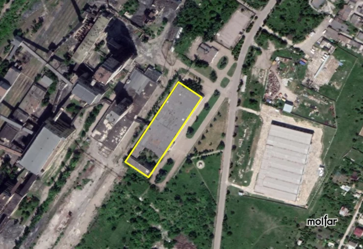
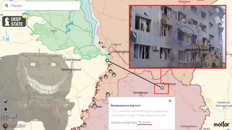
📍 Exact coordinates of the object that we managed to find: 48°33'07.9"N 39°10'39.5"E
Evidence of finding the object
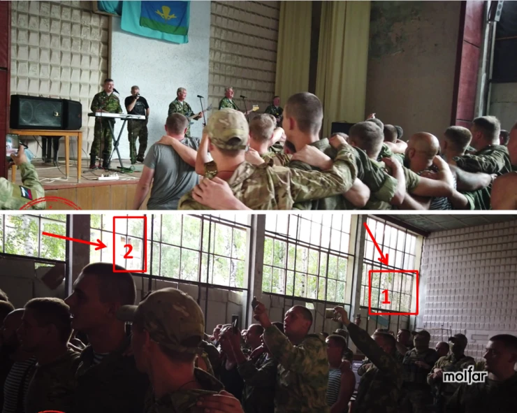
The video captured a significant number of military personnel, as well as the probable П-shaped building architecture: part of the building (1), windows opposite (2) and trees inside the courtyard.
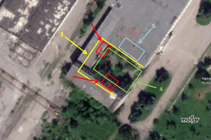
Possible objects in the picture.
- Part of the building that could be caught on video.
- Windows that could be caught on video.
- П-shaped architecture of the building.
- Trees inside the yard that could be caught on video.
- The probable location of the assembly hall, from where the shooting took place.
Based on the materials provided, it can be concluded that yes, this is exactly this building – that's where the Russian soldiers were. And the main word is "were".
What was used for the strike mission?
According to the nature of the destruction, it can be seen that a high-precision weapon with a small warhead was used. The distance from the affected object to the nearest possible launch site of the projectile or rocket is almost 80 km. Most likely, reactive guided projectiles for HIMARS systems were used to destroy the object.
Thanks to the Armed Forces of Ukraine for this case 🇺🇦🥸 It’s not only a great benefit, but also an opportunity to study OSINT and GEOINT using real examples. Thank you!
✉️ To contact the team and receive a comment, fill out the form below, or send your request to: [email protected]